+976 9904-08-33 (Mongolia, Ulaanbaatar UTC+8) +7 (916) 445-30-00 (Russia, Moscow UTC+3)
GEOLOGY & EXPLORATION
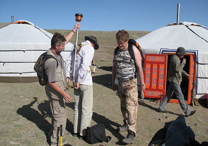
Exploration project start-up
geological prognosis and prospecting study of defined by Client areas in Mongolia includes historical geological data collection, review and analyzing, field evaluation and mapping, providing reliable forecast, regional geological reviews, regional exploration targeting, review and validation of historic data, including validation of resources, data validation and migration into spatial database environments (2D/3D), final exploration targets selection.
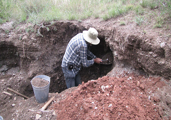
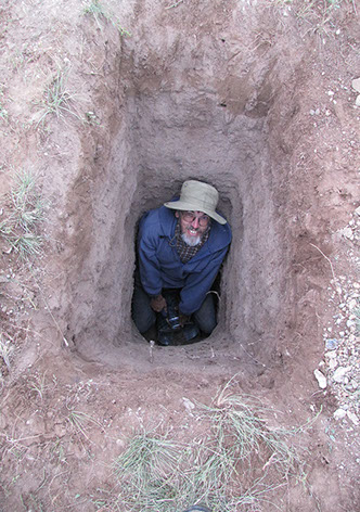
Geological Mapping and Analysis of Drill Hole Data
includes base mapping, drill core logging, structural mapping to define geometry and mineralisation controls at regional to mine scales, interpretation of multiple datasets in an integrated 3D environment, expert analytical support to solve specific issues.
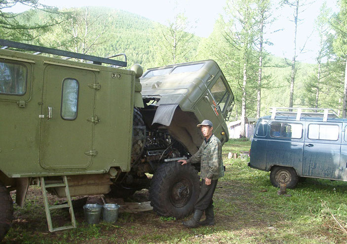
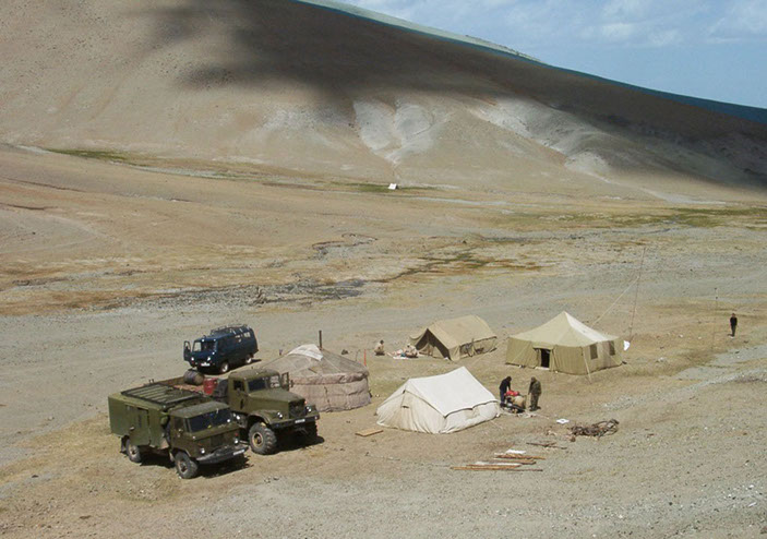
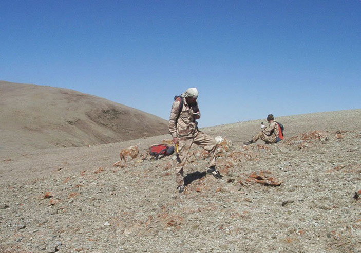
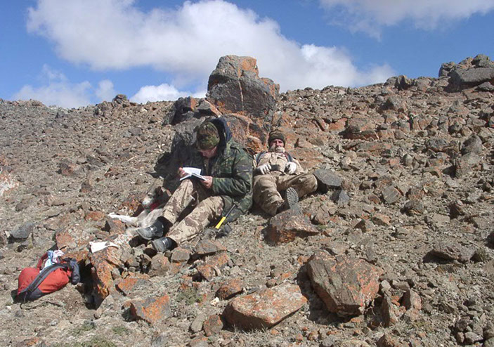
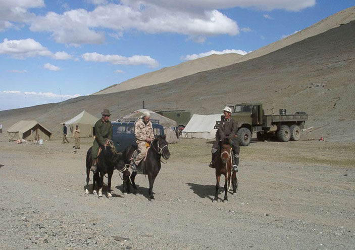
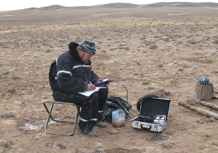
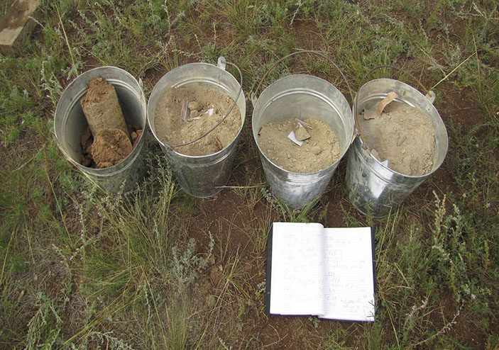
Complete field data collection and management
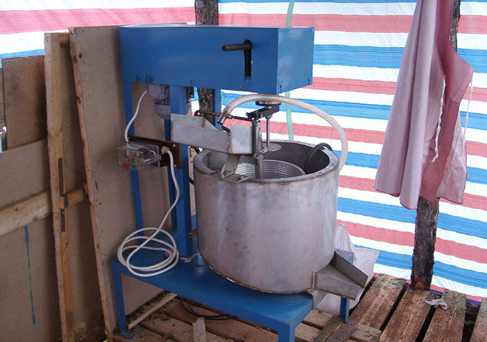
geological field data capture, drill hole data logging, mapping, sampling (collection, preparation, processing).
Resource modeling and estimation
evaluations of exploration properties, reviews of exploration sampling results, optimization of drill hole targeting for resource definition, exploration and database management, creation of 2D and 3D geological, structural and mineralisation models, statistical and geostatistical analyses, resource estimation, classification and reporting for all stages of projects, reviews of geological interpretations and resource estimates. Reserves calculation based on different methodology. Preparation of reserves calculation according to Mongolian requirements.
- exploration of deposits - drilling - JORC reserves calculation - feasibility study of conditions - preparation for production -
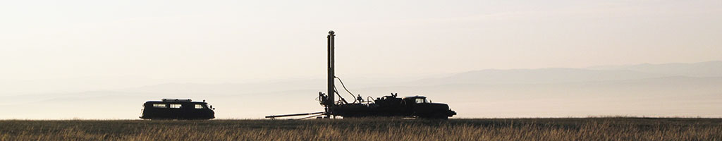
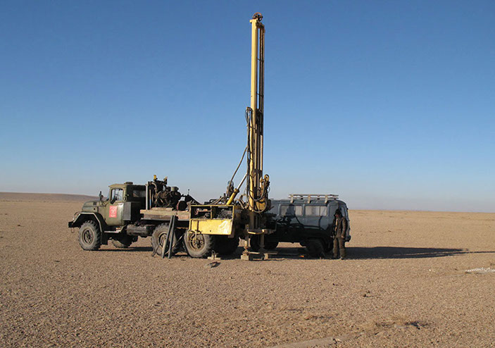
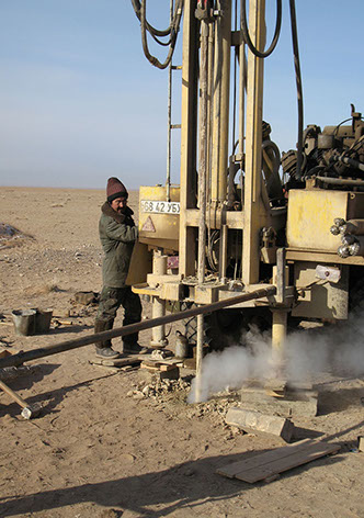
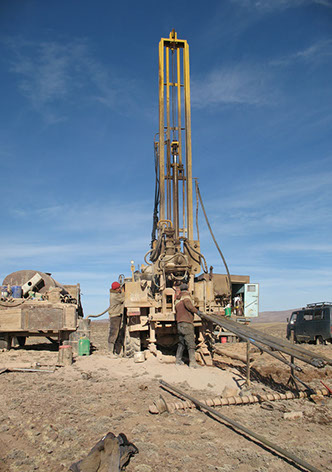
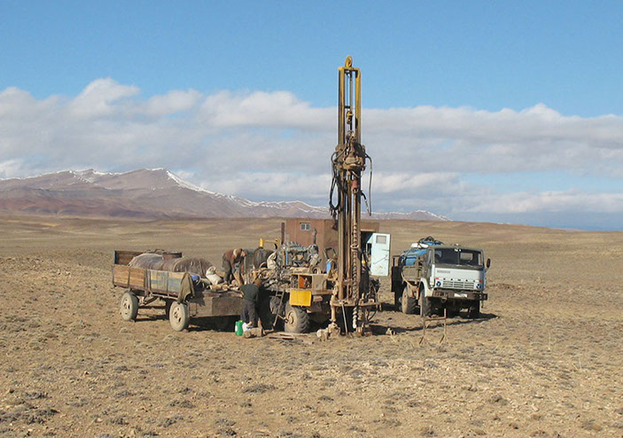
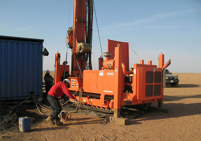
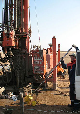
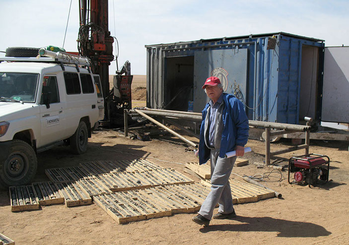
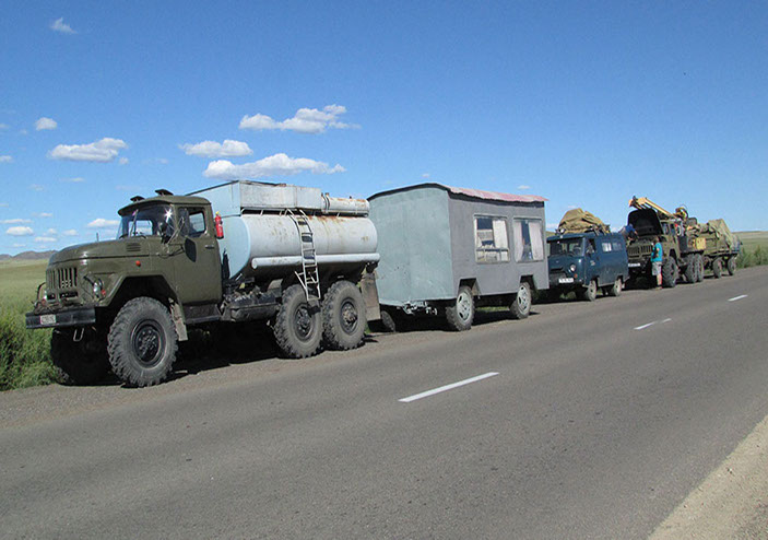
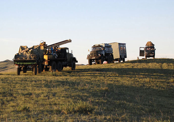
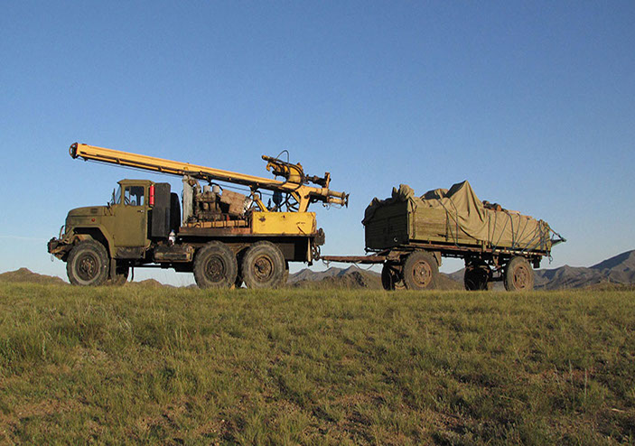
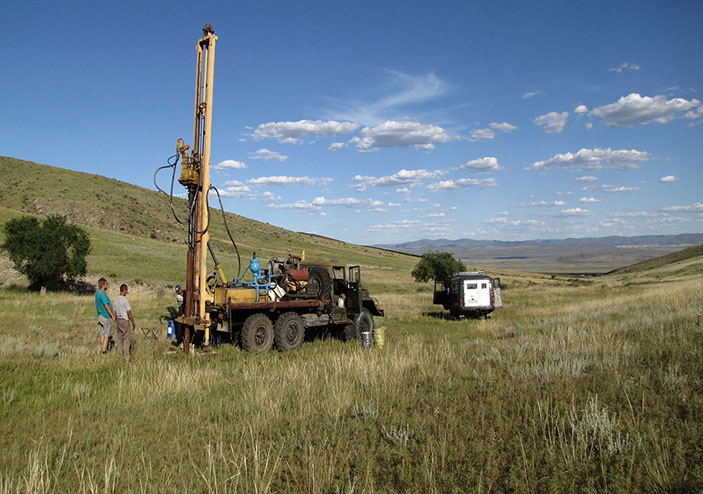
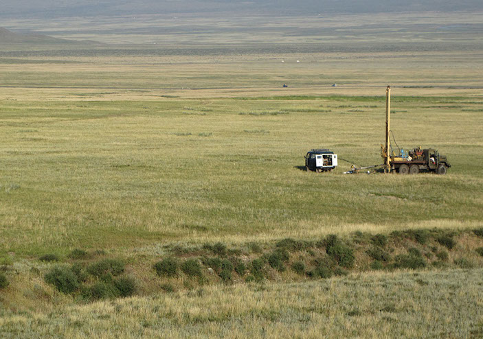
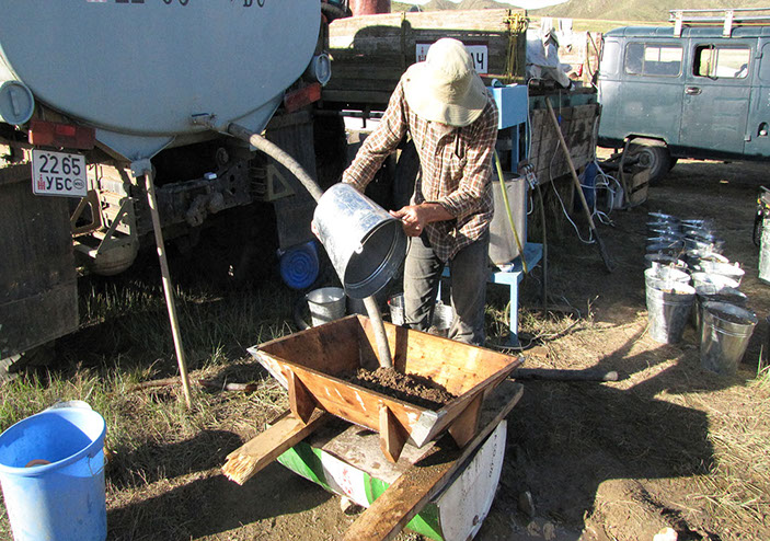
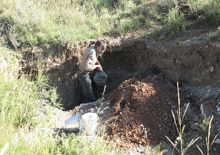
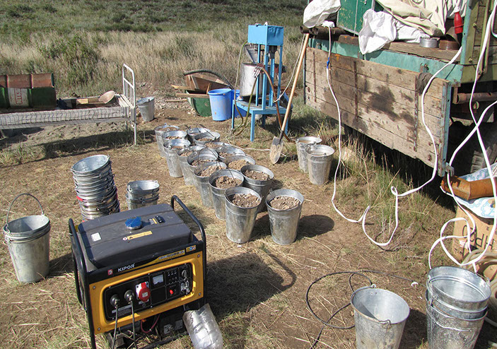
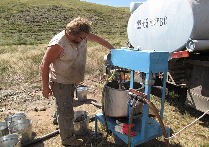
EXPLORATION DRILLING
Drilling is primary and most effective method of exploration to prove and verify reliability of geological data and declared mineral reserves.
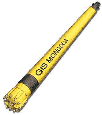
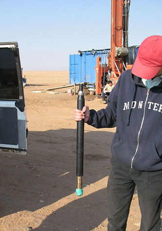
Boreholes drilling - cuttings open hole, core diamond drilling (PQ,HQ,NQ), RM, RC;
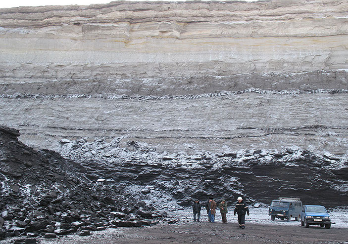
Maximum drilling depth is 1500 m (NQ core) with not less than 95% of core recovery includes drilling of coal-bearing formations
Hydrological or engineering boreholes drilling, drilling of monitoring boreholes.
We confident to drill monitoring hydrological boreholes for quality and quantity underground water control within mining areas of Mongolia. We also provide with drilling of engineering boreholes with sampling for chemical/physical rocks and ores properties study.
Drilling on placer type deposits (Au, Pt-Pd, Sn): drilling diameter is 152 & 174 (178) & 204 mm, drilling depth up to 80 m includes drilling in difficult geological conditions
.jpg?crc=368602684)
.jpg?crc=4042488449)
.jpg?crc=481775793)
.jpg?crc=4003388507)
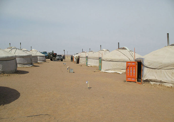
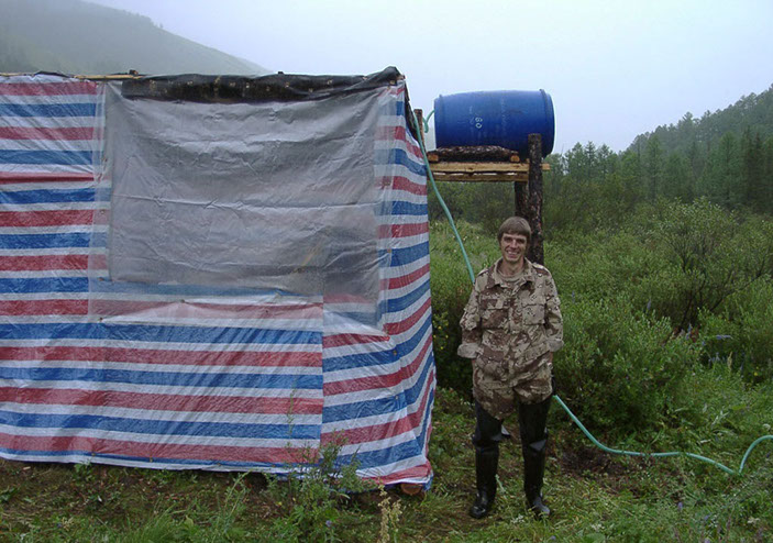
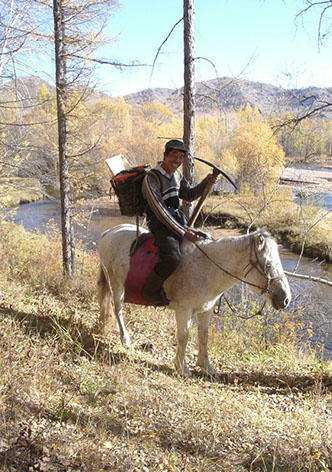
Аймаг Сэлэнгэ, Тушиг сомон
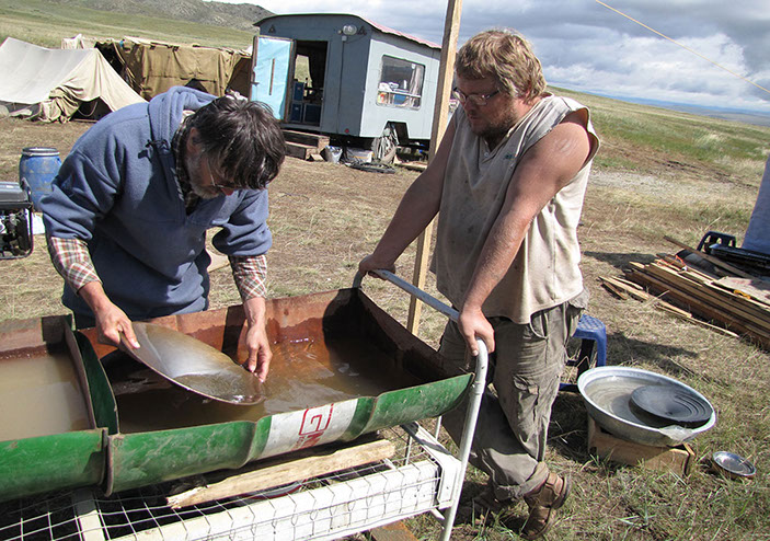
Поисково-оценочные работы на россыпь (2001)
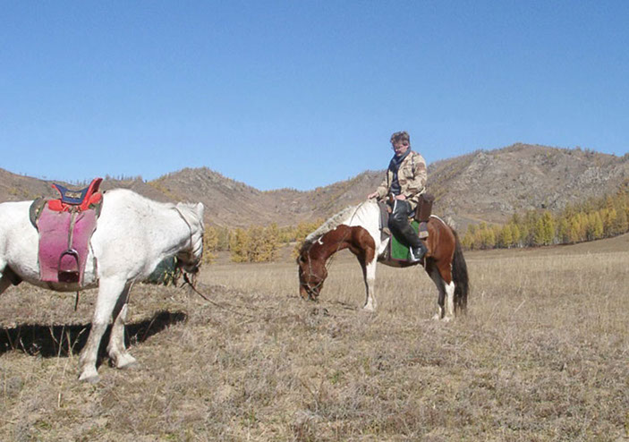
Аймаг Сэлэнгэ, Тушиг сомон
Поисково-оценочные работы на россыпь (2001)
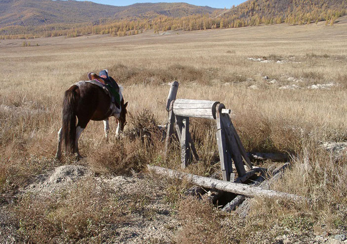
Аймаг Сэлэнгэ, Тушиг сомон
Поисково-оценочные работы на россыпь (2001)
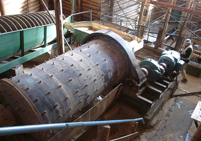
Аймаг Сэлэнгэ, Тушиг сомон
Поисково-оценочные работы на россыпь (2001)
Баянхонгорский аймаг, Их-Богдинский гипербазитовый массив
поисково-оценочные работы на хромиты (2002)
Аймаг Говь-Алтай, Наранский гипербазитовый массив
поисково-оценочные работы на хромиты (2002)
Аймаг Говь-Алтай, Наранский гипербазитовый массив
поисково-оценочные работы на хромиты (2002)
Аймаг Говь-Алтай, Наранский гипербазитовый массив
поисково-оценочные работы на хромиты (2002)
Аймаг Говь-Алтай, Наранский гипербазитовый массив
поисково-оценочные работы на хромиты (2002)
Аймаг Говь-Алтай, Наранский гипербазитовый массив
поисково-оценочные работы на хромиты (2002)
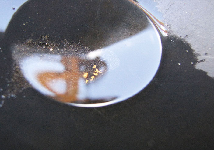
Булган аймаг, Тэшиг сомон, долина реки Тавт
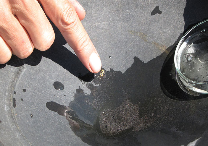
поисково-оценочные работы на золото (2003)
Булган аймаг, Тэшиг сомон, долина реки Тавт
поисково-оценочные работы на золото (2003)
Булган аймаг, Тэшиг сомон, долина реки Тавт
поисково-оценочные работы на золото (2003)
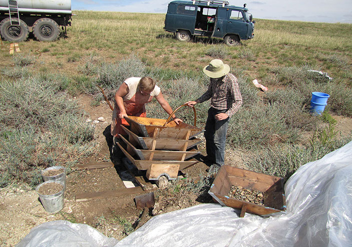
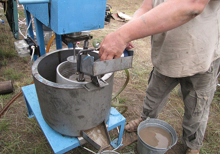
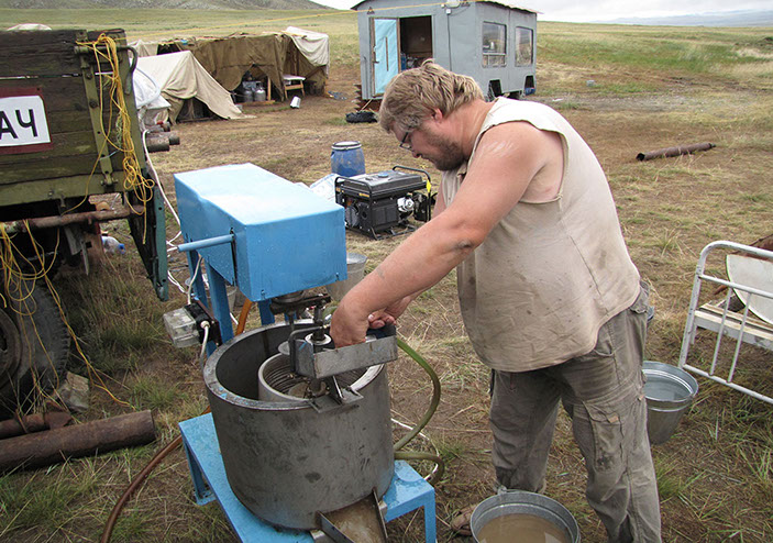
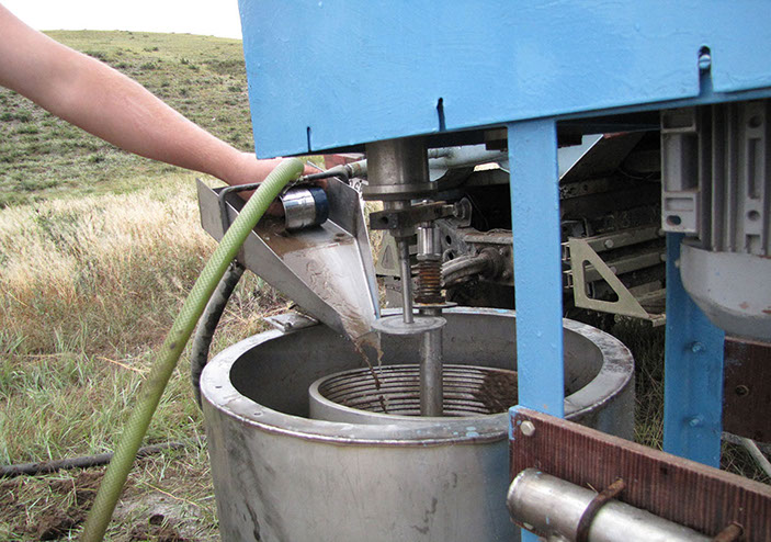
Булган аймаг, Тэшиг сомон, долина реки Тавт
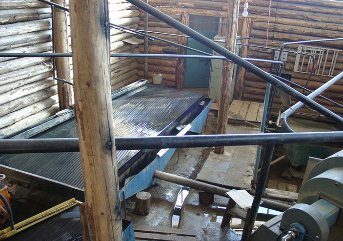
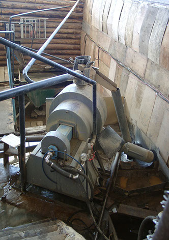
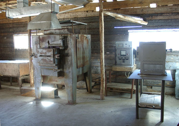
запуск ЗИФ на участке (2003)
Булган аймаг, Тэшиг сомон, долина реки Тавт
запуск ЗИФ на участке (2003)
Булган аймаг, Тэшиг сомон, долина реки Тавт
запуск ЗИФ на участке (2003)
Булган аймаг, Тэшиг сомон, долина реки Тавт
запуск ЗИФ на участке (2003)
Булган аймаг, Тэшиг сомон, долина реки Тавт
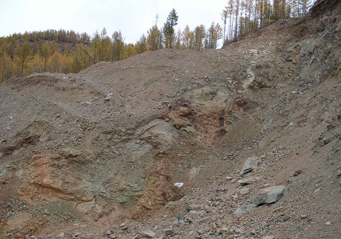
тело кварц-серицитовых метасоматитов с промышленным золотом (2003)
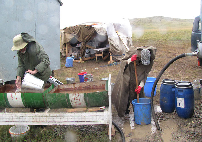
Булган аймаг, Тэшиг сомон, долина реки Тавт
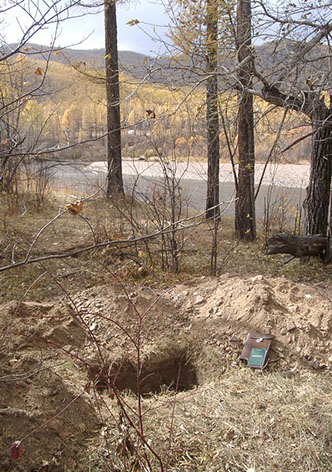
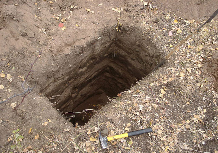
шурфовая разведка россыпи (2003)
Булган аймаг, Тэшиг сомон, долина реки Тавт
шурфовая разведка россыпи (2003)
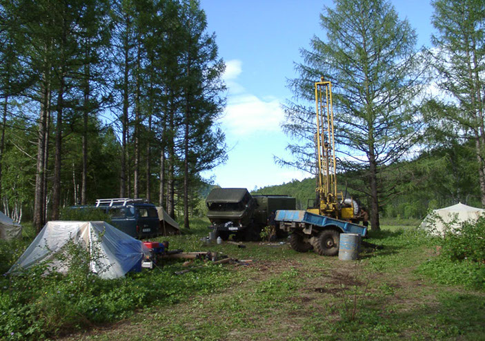
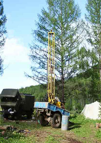
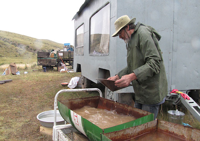
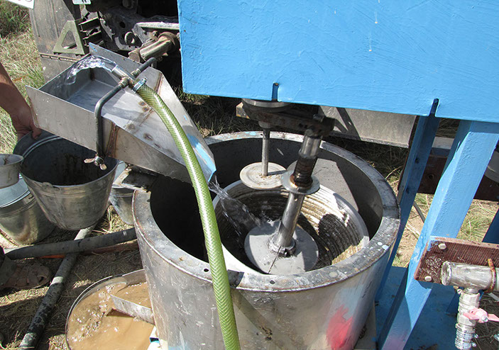
Сэлэнгэ аймаг, Тушиг сомон, долина реки Гурамсны-Гол
разведочное бурение на россыпном участке (2002)
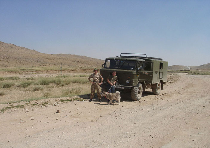
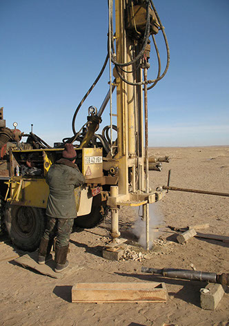
Говь-Сумбэр аймаг (Чойр), месторождение Шивээ-Овоо южное
селективное бурение углевмещающих толщ (2007)
Говь-Сумбэр аймаг (Чойр), месторождение Шивээ-Овоо южное
селективное бурение углевмещающих толщ (2007)
Говь-Сумбэр аймаг (Чойр), месторождение Шивээ-Овоо южное
селективное бурение углевмещающих толщ (2007)
Говь-Сумбэр аймаг (Чойр), месторождение Шивээ-Овоо южное
селективное бурение углевмещающих толщ (2007)
Говь-Сумбэр аймаг (Чойр), месторождение Шивээ-Овоо южное
селективное бурение углевмещающих толщ (2007)
Говь-Сумбэр аймаг (Чойр), месторождение Шивээ-Овоо южное
селективное бурение углевмещающих толщ (2007)
Говь-Сумбэр аймаг (Чойр), месторождение Шивээ-Овоо южное
селективное бурение углевмещающих толщ (2007)
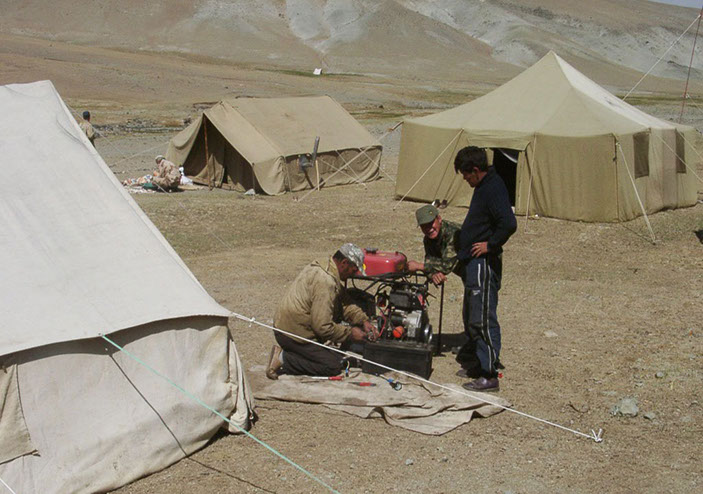
Увс аймаг, Давст сомон (2010)
поисково-оценочное бурение на объекте калийных солей
Увс аймаг, Давст сомон (2010)
поисково-оценочное бурение на объекте калийных солей
Увс аймаг, Давст сомон (2010)
поисково-оценочное бурение на объекте калийных солей
Увс аймаг, Давст сомон (2010)
поисково-оценочное бурение на объекте калийных солей
Увс аймаг, Давст сомон (2010)
поисково-оценочное бурение на объекте калийных солей
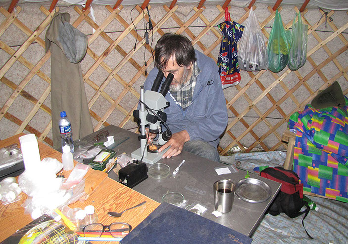
Месторождение бурых углей Шивээ-Овоо (2007)
тематические работы
Дорнговь аймаг (2009)
детальная разведка буроугольного месторождения
Дорнговь аймаг (2009)
детальная разведка буроугольного месторождения
Дорнговь аймаг (2009)
детальная разведка буроугольного месторождения
Дорнговь аймаг (2009)
детальная разведка буроугольного месторождения
Дорнговь аймаг (2009)
детальная разведка буроугольного месторождения
Аймаг Говь-Алтай (2007), Наранский гипербазитовый массив
рекогносцировочные работы на хромитовом рудопроявлении
Аймаг Говь-Алтай (2007), Наранский гипербазитовый массив
рекогносцировочные работы на хромитовом рудопроявлении
Аймаг Говь-Алтай (2007), Наранский гипербазитовый массив
рекогносцировочные работы на хромитовом рудопроявлении
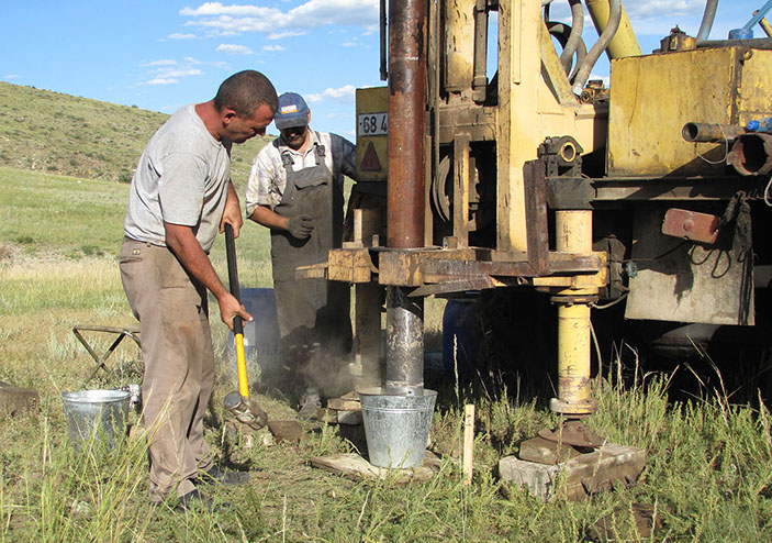
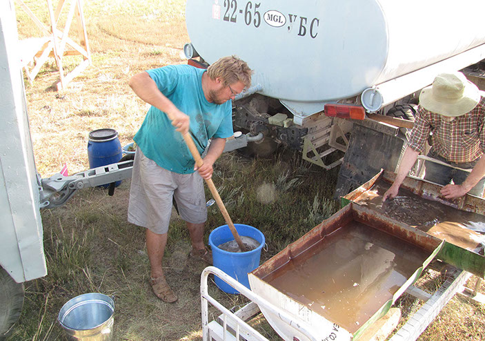
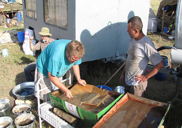
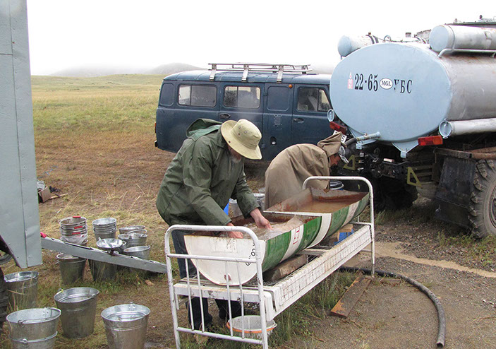
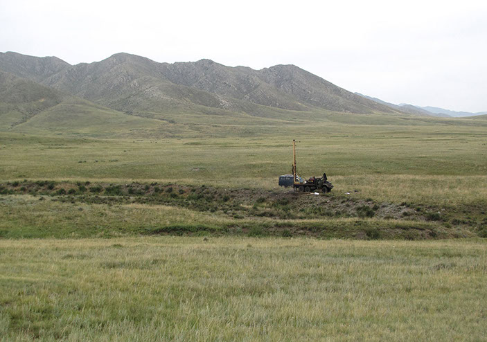
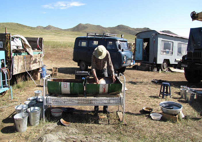
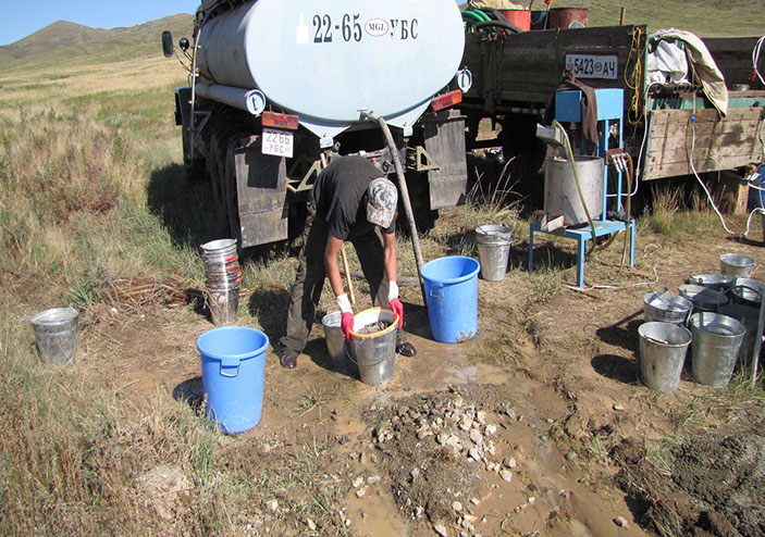
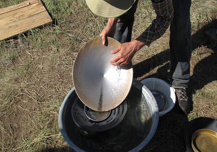
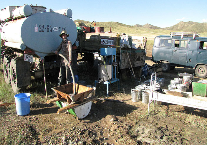
Центральный (Тув) аймаг, Лун сомон (2011)
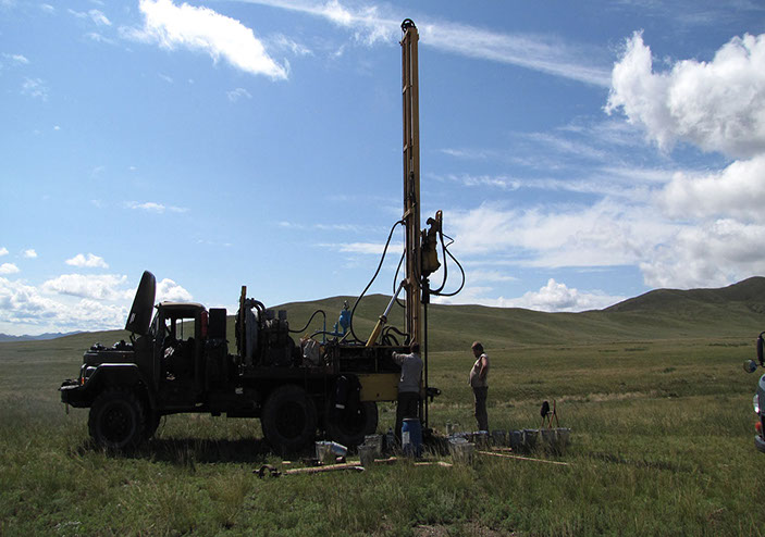
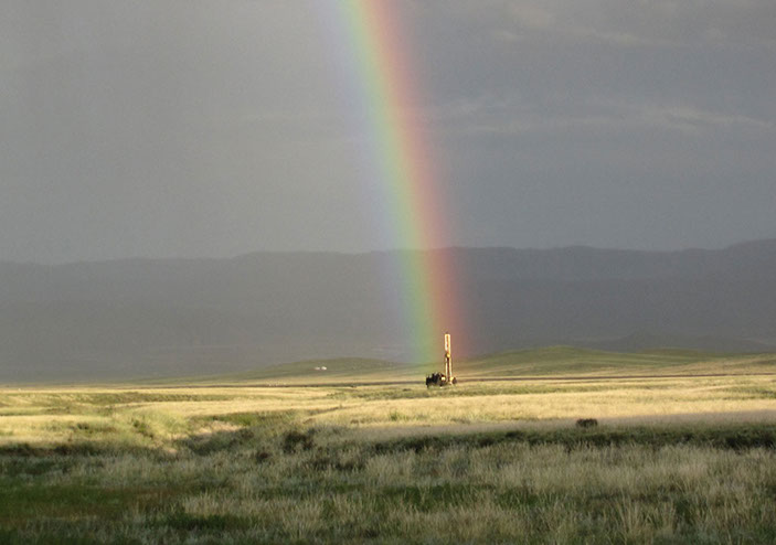
Разведочное бурение на участке россыпного месторождения
Центральный (Тув) аймаг, Лун сомон (2011)
Разведочное бурение на участке россыпного месторождения
Центральный (Тув) аймаг, Лун сомон (2011)
Разведочное бурение на участке россыпного месторождения
Центральный (Тув) аймаг, Лун сомон (2011)
Разведочное бурение на участке россыпного месторождения
Центральный (Тув) аймаг, Лун сомон (2011)
Разведочное бурение на участке россыпного месторождения
Центральный (Тув) аймаг, Лун сомон (2011)
Разведочное бурение на участке россыпного месторождения
Центральный (Тув) аймаг, Лун сомон (2011)
Разведочное бурение на участке россыпного месторождения
Центральный (Тув) аймаг, Лун сомон (2011)
Разведочное бурение на участке россыпного месторождения
Центральный (Тув) аймаг, Лун сомон (2011)
Разведочное бурение на участке россыпного месторождения
Центральный (Тув) аймаг, Лун сомон (2011)
Разведочное бурение на участке россыпного месторождения
Центральный (Тув) аймаг, Лун сомон (2011)
Разведочное бурение на участке россыпного месторождения
Центральный (Тув) аймаг, Лун сомон (2011)
Разведочное бурение на участке россыпного месторождения
Центральный (Тув) аймаг, Лун сомон (2011)
Разведочное бурение на участке россыпного месторождения
Центральный (Тув) аймаг, Лун сомон (2011)
Разведочное бурение на участке россыпного месторождения
Центральный (Тув) аймаг, Лун сомон (2011)
Разведочное бурение на участке россыпного месторождения
Центральный (Тув) аймаг, Лун сомон (2011)
Разведочное бурение на участке россыпного месторождения
Центральный (Тув) аймаг, Лун сомон (2011)
Разведочное бурение на участке россыпного месторождения
Центральный (Тув) аймаг, Лун сомон (2011)
Разведочное бурение на участке россыпного месторождения
Центральный (Тув) аймаг, Лун сомон (2011)
Разведочное бурение на участке россыпного месторождения
Центральный (Тув) аймаг, Лун сомон (2011)
Разведочное бурение на участке россыпного месторождения
Центральный (Тув) аймаг, Лун сомон (2011)
Разведочное бурение на участке россыпного месторождения
Lorem ipsum dolor sit amet.64Центральный (Тув) аймаг, Лун сомон (2011)
Разведочное бурение на участке россыпного месторождения
Центральный (Тув) аймаг, Лун сомон (2011)
Разведочное бурение на участке россыпного месторождения
Центральный (Тув) аймаг, Лун сомон (2011)
Разведочное бурение на участке россыпного месторождения
Центральный (Тув) аймаг, Лун сомон (2011)
Разведочное бурение на участке россыпного месторождения
Центральный (Тув) аймаг, Лун сомон (2011)
Разведочное бурение на участке россыпного месторождения
Центральный (Тув) аймаг, Лун сомон (2011)
Разведочное бурение на участке россыпного месторождения
Центральный (Тув) аймаг, Лун сомон (2011)
Разведочное бурение на участке россыпного месторождения
Центральный (Тув) аймаг, Лун сомон (2011)
Разведочное бурение на участке россыпного месторождения
Центральный (Тув) аймаг, Лун сомон (2011)
Разведочное бурение на участке россыпного месторождения
Центральный (Тув) аймаг, Лун сомон (2011)
Разведочное бурение на участке россыпного месторождения
Центральный (Тув) аймаг, Лун сомон (2011)
Разведочное бурение на участке россыпного месторождения
Центральный (Тув) аймаг, Лун сомон (2011)
Разведочное бурение на участке россыпного месторождения
Центральный (Тув) аймаг, Лун сомон (2011)
Разведочное бурение на участке россыпного месторождения
41 - 76